|
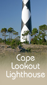
 Cape Lookout Lighthouse
Fact Sheet:
- Completed
- (activated) Nov. 1, 1859
- Height
to top - 163 ft. above ground, 169 ft. above sea level
- Height
to focal plane - 150 ft. above mean high water
- Beacon
Type - 2 DCB-24 rotating airport beacons (back to back),
each with 1000 watt light
- Beacon
distance - 18-19 nautical miles (about 16.5 statute miles)
- Light
pattern - One complete rotation each 30 sec. which gives
flash each 15 sec. or 4 flashes per minute (24 hrs./day)
- No.
of lighthouse steps - 201 iron steps
- Open
to public to climb - Yes. Open Tues. through Sat., mid-May
to mid-September, 9:30 am to 4:00 pm. Tickets- $8 adults
/ $4 for children and seniors.
- Location
- Cape Lookout, South Core Banks, nearest town - Harker's
Island
- Keeper's
House - Open to public - first floor visitor center.
- Management
- Beacon operation maintained by the U.S. Coast Guard. Lighthouse
and grounds owned by the National Park Service
- How
to get there - By private boat, public dock available but
no tie-up permitted - only unloading. Anchor along beach.
Also by private passenger ferry runs from Harker's Island
or Beaufort - see list of NPS
approved ferry services.
|
For
many long years Cape Lookout Lighthouse was not open to the
public, except on rare special occasions. All these photos were
taken years before it was renovated and finally opened to
the public on a regular schedule on July 15, 2010. You will
view Cape Lookout as few people had ever seen it prior to that
time.
With the lighthouse finally renovated
and safe for the public to climb it, more people will have the
chance to take the tour as presented here. In 2004, this tour
was a very special treat indeed. Now though, everyone can have
the opportunity to see the magnificent vista afforded from the
gallery of Cape Lookout Lighthouse. It is a panorama unmatched
by any of North Carolina's other lighthouses.
Cape Lookout Lighthouse might be called
the least accessible of those on the Outer Banks because it
is only accessible by boat. However, the trip is well worth
the effort. The view from the lighthouse alone is worth the
expense and time invested.
|
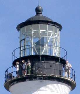
An
extremely rare sight prior to 2010:
Visitors on the gallery of
Cape Lookout Lighthouse. |
 |
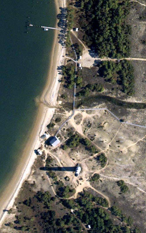
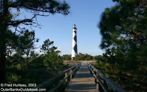
This
tour best begins with a familiarization of the layout at the
Cape
Lookout Light Station site. In September, 2003, just after
Hurricane Isabel, NOAA took aerial photos of the entire Outer
Banks, including all the lighthouses. In this NOAA photo of
Cape Lookout, north is at the top, corresponding to the way
we normally think of the compass. There is boardwalk access
that runs from the pier on the sound (upper left of photo) all
the way to the Keeper's Quarters (near left center), and branches
off to run east most of the way to the ocean beachfront. It
is reasonably easy to walk down the beach from the pier to the
lighthouse as well. The boardwalk spans the small creek, but
taking the beach route crosses any creek outflow that might
be present. The lighthouse shadow is prominent in the lower
center of the photo. In the upper center, just south and east
of the pier, is a large sandy patch and a road leading east.
This is the staging area for 4WD tours by NPS-approved guide
services. |
Photos
courtesy
of NOAA |
 |
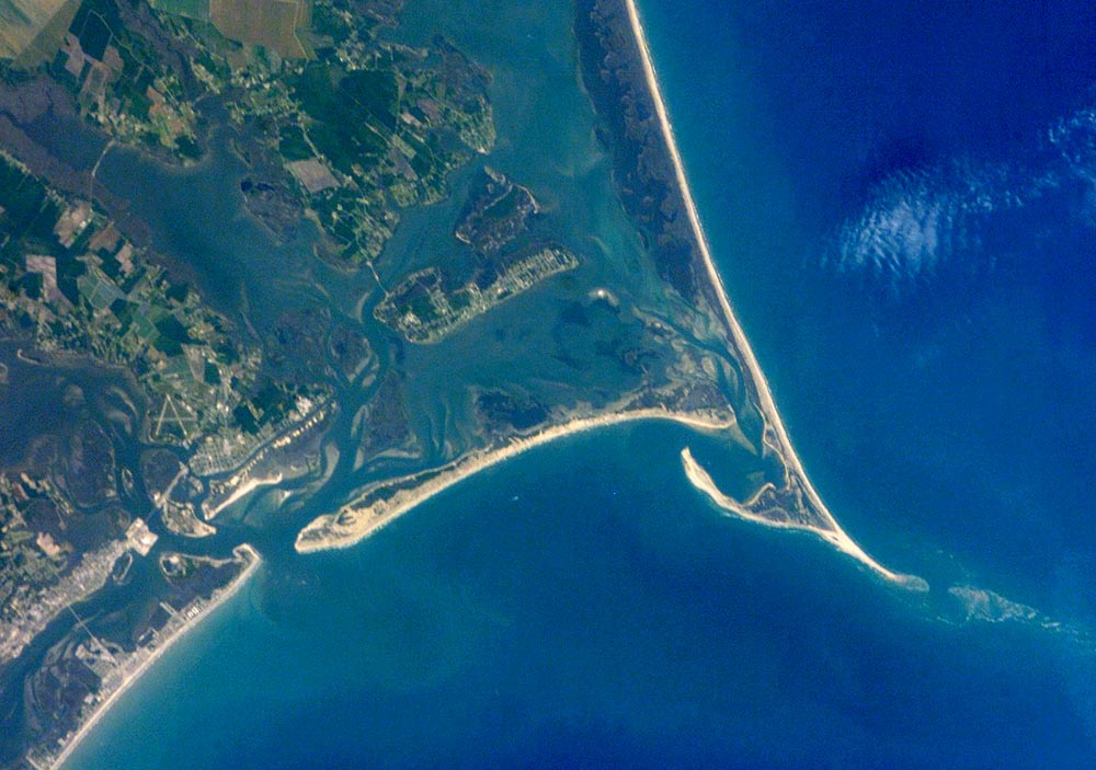
The
satellite
photo at left, also from NOAA, shows a wider view to orient
yourself to the area. Compare this with the Coastal
Guide Map to get your bearings. This satellite image provides
a great view of Cape Lookout, South Core Banks, Shackleford
Banks, Harker's Island, Beaufort Inlet, Beaufort, Morehead City,
Atlantic Beach and much of Bogue Banks. It also shows how far
the shallows extend out beyond the cape point into the ocean. |

 Two
initial trips were made to Cape Lookout Lighthouse for photos
and information for these pages: one in late October, 2003,
and one in early November, 2003. Both "expeditions" were staged
from Harker's Island for three reasons. Harker's Island is the
shortest private ferry ride to Cape Lookout; the sunrise, sunset
and bird photo opportunities were better than Beaufort (the
other possible choice); and it was right on the way to Cedar
Island for the ferry ride to the next stop on both trips - Ocracoke.
Two
initial trips were made to Cape Lookout Lighthouse for photos
and information for these pages: one in late October, 2003,
and one in early November, 2003. Both "expeditions" were staged
from Harker's Island for three reasons. Harker's Island is the
shortest private ferry ride to Cape Lookout; the sunrise, sunset
and bird photo opportunities were better than Beaufort (the
other possible choice); and it was right on the way to Cedar
Island for the ferry ride to the next stop on both trips - Ocracoke. |
|

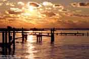
Both boat
and lighthouse glow in the golden light of a spectacular
sunrise (far left), in this telephoto image taken from Harker's
Island. The lighthouse seems to rise
from a mirage in the chilly air of an October morning. |
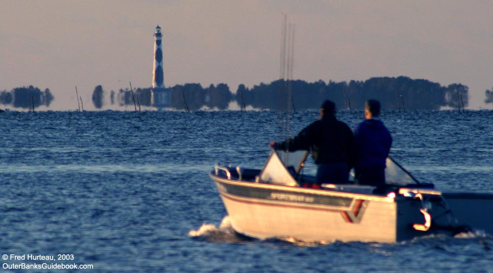
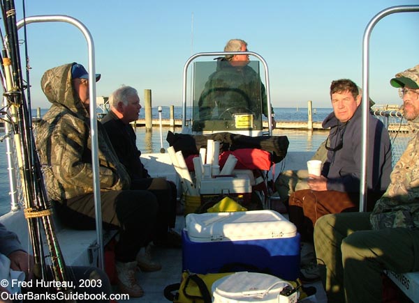
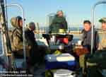 Getting
to the lighthouse is as easy as riding one of the private
passenger ferry services from Beaufort (see list of NPS
approved ferry services). This photo
shows several fishermen
taking the ferry for a day of surf fishing at the
cape. Getting
to the lighthouse is as easy as riding one of the private
passenger ferry services from Beaufort (see list of NPS
approved ferry services). This photo
shows several fishermen
taking the ferry for a day of surf fishing at the
cape.
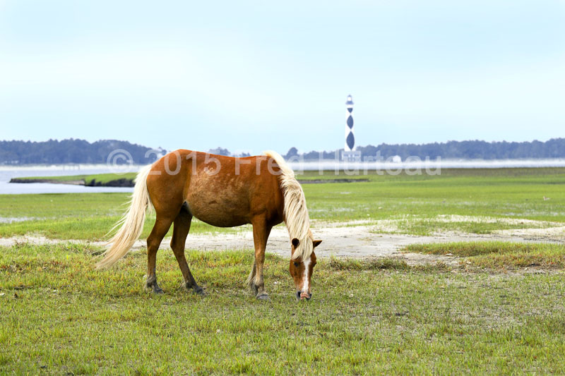
 The
ferry must round the east end of Shackleford Banks to reach
the lighthouse. If you're lucky, you might spot wild
horses on Shackleford as we did. These ferry services will
also take people to Shackleford Banks and pick them up on a
schedule. The
ferry must round the east end of Shackleford Banks to reach
the lighthouse. If you're lucky, you might spot wild
horses on Shackleford as we did. These ferry services will
also take people to Shackleford Banks and pick them up on a
schedule.

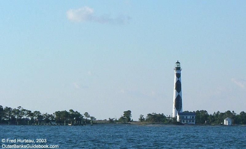
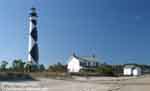
The lighthouse is visible from Harker's
Island. It's virtually impossible
to take a photo while bouncing across the water. But once
you get closer and the ferry slows down, you can likely
get a nice photo
from offshore.
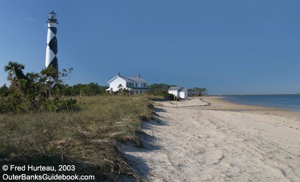
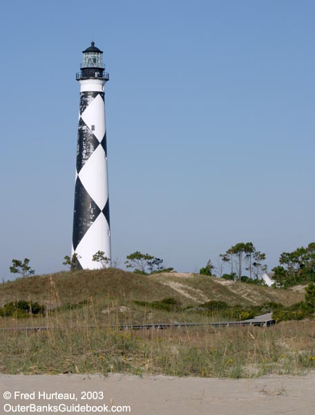
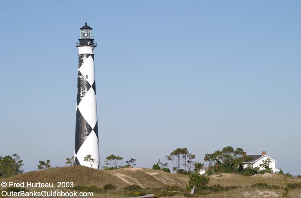
 When
you reach shore, your first views of the light station will
be looking
up the beach, or walking along
the boardwalk.
When
you reach shore, your first views of the light station will
be looking
up the beach, or walking along
the boardwalk.
 Hurricane
Isabel caused more erosion in front
of the Keeper's Quarters and toppled the coal shed
in front of the house. It also broke apart the concrete
foundation for the coal shed, so the collapsed structure
had to be removed for safety, and for aesthetic reasons
as well. Hurricane
Isabel caused more erosion in front
of the Keeper's Quarters and toppled the coal shed
in front of the house. It also broke apart the concrete
foundation for the coal shed, so the collapsed structure
had to be removed for safety, and for aesthetic reasons
as well.
 The
Keeper's Quarters has a tiny gift shop and a one-room
"museum" of artifacts from the light station.
The
Keeper's Quarters has a tiny gift shop and a one-room
"museum" of artifacts from the light station.
Walking
back
along the boardwalk and east toward the ocean you
will pass several mounds with stone rubble. |
 |
 These
mounds
(left photo) are said to mark an earlier Keeper's Quarters,
the first (1812) tower location, and other former structures.
The photo at right is a different
angle taken from the "road", and shows the boardwalk. These
mounds
(left photo) are said to mark an earlier Keeper's Quarters,
the first (1812) tower location, and other former structures.
The photo at right is a different
angle taken from the "road", and shows the boardwalk.
|
 |
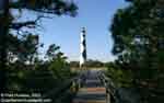
 The
left photo, taken from
the boardwalk, gives yet another view of the lighthouse,
Keeper's Quarters and the mounds. The
left photo, taken from
the boardwalk, gives yet another view of the lighthouse,
Keeper's Quarters and the mounds.
The boardwalk
takes you out to the ocean beach, shown in the photo at
right taken from the lighthouse gallery. The dunes are badly
damaged, having been torn down and washed inland by Hurricane
Isabel only six weeks before. The day this photo was taken was
the first time since the storm that the "roads" on Cape Lookout
were reopened to the 4WD tour vehicles. |

The
foreground in the left photo shows more detail
of the rubble on one of the mounds. The photo at right shows
some of the largest sections of stone, still mortared together.
This would appear to be part of the base for an earlier lighthouse.
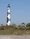
By now you have surely noticed that the
lighthouse
is in dire need of repainting. The paint problem was there long
before Hurricane Isabel came to visit. There was a problem with
the paint being the wrong kind or improperly applied the last
time it was painted, and it has been deteriorating for quite
some time.
|
| Continue
to Cape Lookout Lighthouse - Page
Two > |
Cape
Lookout
Lighthouse |
 |
|