|
History,
legend and folklore come together on the
Outer Banks when you speak of the Graveyard
of the Atlantic. There have been more than
a thousand documented shipwrecks along
these barrier islands, with a tale to go
with each of them.
What
created the Graveyard of the Atlantic?
|

Click
on image for larger view.
|
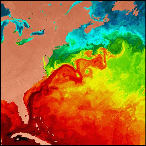
 The
Outer Banks protrude eastward into the Atlantic so that ships
traveling north and south tend to stay near shore to shorten
their trips. But the ocean is shallow along the "Banks" and
several natural forces shift the ocean sand constantly, piling
it into "shoals". One of the most infamous shoals is off Cape
Hatteras point. The NASA image at left shows how the warm
Gulf Stream (in reds) flows north from Florida, hugging
the coast until it reaches Cape Hatteras. Here it slams into
the cold northern waters of the Labrador Current (in blue and
green). This clash of currents created Diamond Shoals. The
Outer Banks protrude eastward into the Atlantic so that ships
traveling north and south tend to stay near shore to shorten
their trips. But the ocean is shallow along the "Banks" and
several natural forces shift the ocean sand constantly, piling
it into "shoals". One of the most infamous shoals is off Cape
Hatteras point. The NASA image at left shows how the warm
Gulf Stream (in reds) flows north from Florida, hugging
the coast until it reaches Cape Hatteras. Here it slams into
the cold northern waters of the Labrador Current (in blue and
green). This clash of currents created Diamond Shoals. |
| Additionally,
hurricanes rip their way up the
Atlantic coastline from the south,
and "Nor'easters" blow down from
the north. The wind and swirling
ocean currents caused by all these
factors shift the sands of the
ocean bottom, piling it into shoals,
which hide just beneath the water's
surface. This creates treacherous
areas where ships run aground.
When this happens in a storm, ships
can be torn apart by huge waves.
Even if they avoid the shoals,
they still could be blown close
to shore and dashed to pieces in
the surf like the Altoona at right. |
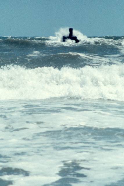
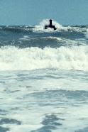
Below:
The Altoona,
wrecked Oct. 22, 1878.

Click
for larger view. Photo by Fred Hurteau. |
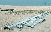
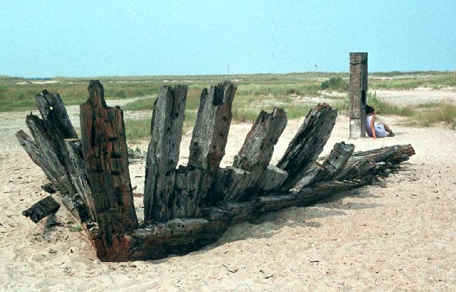
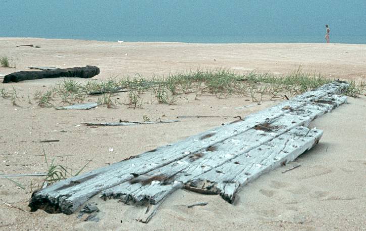
Click
on images for larger view.
Photos by Fred Hurteau.
Above: Unmarked
wreckage lies on the beach waiting
to be covered or moved by the next
Hurricane.
Far Right: The Oriental,
a federal transport which sank May
8, 1862, is pounded by ocean surf
near Pea Island Visitor Center.
Below: This unmarked wreck
is barely visible in calm water just
off the beach. |
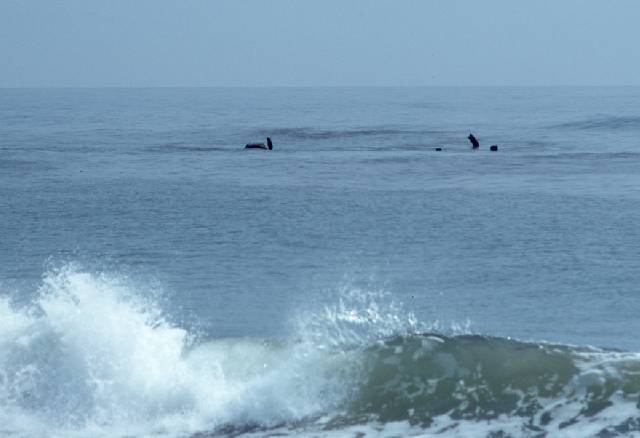
Most
of the shipwrecks occurred along the
Outer Banks before the advent of
modern weather prediction and satellite
imaging because there was little
or no warning of dangerous storms.
Hurricanes, tropical storms and nor'easters
seemed to appear from nowhere, trapping
ships in these treacherous waters.
|
A
Little History
German submarine attacks accounted
for a great number of the 20th Century
shipwrecks in these waters. In the
summer of 1918, World War I German
U-boats began causing havoc along
the Outer Banks. Then again in World
War II, one month after Pearl Harbor
was bombed, German U-boats appeared
along the Outer Banks and sank 60
ships in a very short time. After
the U.S. finally took measures to
stop the U-boats only 4 other ships
were sunk off the Outer Banks by
the Germans through the rest of the
war. |
 While
the occurrence of shipwrecks has decreased drastically
since World War II, ships still can become disabled
and wreck in these waters. Even with modern
navigational aids, radio communication and better
weather information, large ships wrecked along
these dangerous shores in 1954, 1959 and 1961. While
the occurrence of shipwrecks has decreased drastically
since World War II, ships still can become disabled
and wreck in these waters. Even with modern
navigational aids, radio communication and better
weather information, large ships wrecked along
these dangerous shores in 1954, 1959 and 1961.
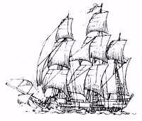
Two Famous Shipwrecks
It was not only storms and treacherous shoals
that sank ships along the Outer Banks. And German
U-boats weren't the only villains to haunt these
waters. Pirates handed out their own brand of
treachery along these barrier islands. The most
infamous pirate of them all, Edward Teach, more
commonly known as Blackbeard,
called these waters home. His flagship, the
Queen Anne's Revenge, went down at Beaufort
Inlet in June of 1718. A shipwreck
believed to be the Queen Annes Revenge,
or "QAR", was discovered near Beaufort
Inlet on Nov. 21, 1996, by Intersal Inc., a
private research firm. |
More information
about the artifacts and research of this shipwreck can be found
at the N.C. Department of Cultural Resources web
site for the QAR. Blackbeard's history, shipwreck research
and other information can be found at the N.C. Maritime Museum.
The second famous shipwreck is one every school
kid learns about, the Civil
War ironclad Monitor ( pictured
below ), which sank somewhere off Cape
Hatteras in a storm on New Year's Eve of 1862.
Its exact whereabouts was unknown until university
researchers discovered the Monitor in
1973 about 17 miles off Cape Hatteras. This
famous shipwreck became the first National
Underwater Marine Sanctuary (photo).
Salvage
and restoration efforts are currently underway. |

Blackbeard
the pirate (above). The USS Monitor
(below). |
|
Back to Folklore and History - Page
One > |
|